
DataSatellite globe →
Satellite watch
37 of 40 watched places have imagery, 0 flagged as changed, 0 dimmer at night. As of 2026-10-30 03:21 UTC. Every change score is a machine signal computed here from two pictures of the same ground: it says pixels differ, never what changed or why. A cloudy pair is inconclusive, not change. A site flagged 'changed' is far outside its own earlier scores; with few earlier looks it is 'learning' and nothing is flagged.
Ozon logistics hub
Learningi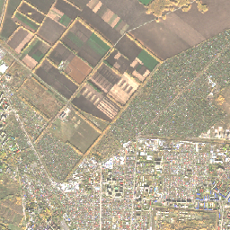
 2026-10-282026-10-15
- Change score
- 0.091
- Pixels changed
- 6.0%
- Clear ground
- 100%
- Cloud now / before
- 0% / 0%
- Night lighti
- Learning, 2026-10-26
0 earlier looks at this site; 5 are needed to judge it against its own normal
Watched: claimed struck on 2026-10-24 (Daily intelligence report). Baseline is the clearest scene before 2026-10-24.
Omsky Kauchuk petrochemical plant
Learningi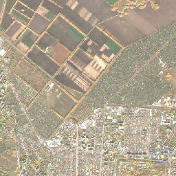
 2026-10-282026-10-15
- Change score
- 0.091
- Pixels changed
- 6.0%
- Clear ground
- 100%
- Cloud now / before
- 0% / 0%
- Night lighti
- Learning, 2026-10-26
0 earlier looks at this site; 5 are needed to judge it against its own normal
Watched: claimed struck on 2026-10-24 (Daily intelligence report). Baseline is the clearest scene before 2026-10-24.
Aramco refinery in Riyadh
Learningi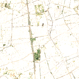
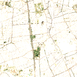 2026-10-212026-10-11
- Change score
- 0.068
- Pixels changed
- 31.8%
- Clear ground
- 100%
- Cloud now / before
- 0% / 0%
- Night lighti
- Learning, 2026-10-21
0 earlier looks at this site; 5 are needed to judge it against its own normal
Watched: claimed struck on 2026-10-14 (Houthi spokesman Yahya Saree). Baseline is the clearest scene before 2026-10-14.
Yemen Petroleum Company al-Sabaha central station
Learningi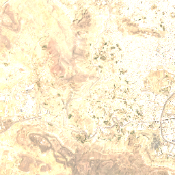
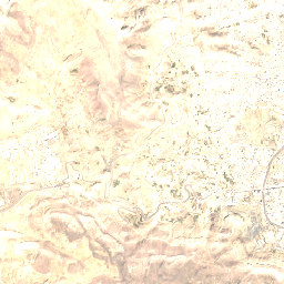 2026-10-212026-10-08
- Change score
- 0.064
- Pixels changed
- 6.2%
- Clear ground
- 100%
- Cloud now / before
- 0% / 0%
- Night lighti
- Learning, 2026-10-21
0 earlier looks at this site; 5 are needed to judge it against its own normal
Watched: claimed struck on 2026-10-13 (Saudi-led coalition). Baseline is the clearest scene before 2026-10-13.
Aramco Yanbu Refinery
Learningi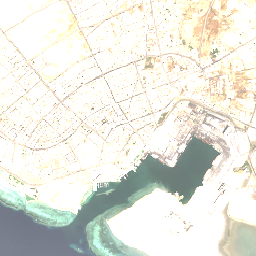
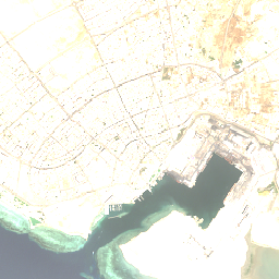 2026-10-252026-10-20
- Change score
- 0.056
- Pixels changed
- 10.3%
- Clear ground
- 100%
- Cloud now / before
- 0% / 0%
- Night lighti
- Learning, 2026-10-23
0 earlier looks at this site; 5 are needed to judge it against its own normal
Watched: claimed struck on 2026-10-24 (Houthi spokesman Yahya Saree). Baseline is the clearest scene before 2026-10-24.
Hodeidah oil terminal
Learningi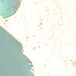
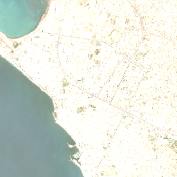 2026-10-212026-10-11
- Change score
- 0.053
- Pixels changed
- 6.8%
- Clear ground
- 100%
- Cloud now / before
- 0% / 0%
- Night lighti
- Learning, 2026-10-21
0 earlier looks at this site; 5 are needed to judge it against its own normal
Watched: claimed struck on 2026-10-13 (Saudi-led coalition). Baseline is the clearest scene before 2026-10-13.
Sberbank Mega Data Center
Learningi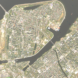
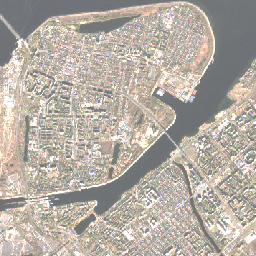 2026-10-272026-10-12
- Change score
- 0.046
- Pixels changed
- 5.9%
- Clear ground
- 100%
- Cloud now / before
- 0% / 0%
- Night lighti
- Learning, 2026-10-26
2 earlier looks at this site; 5 are needed to judge it against its own normal
Watched: reported damaged on 2026-10-13 (reported via themoscowtimes.com). Baseline is the clearest scene before 2026-10-13.
Yeysk airfield
Learningi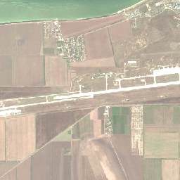
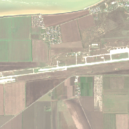 2026-10-262026-10-11
- Change score
- 0.037
- Pixels changed
- 8.9%
- Clear ground
- 100%
- Cloud now / before
- 0% / 0%
- Night lighti
- Learning, 2026-10-26
0 earlier looks at this site; 5 are needed to judge it against its own normal
Watched: claimed struck on 2026-10-24 (General Staff). Baseline is the clearest scene before 2026-10-24.
Badr military camp
Learningi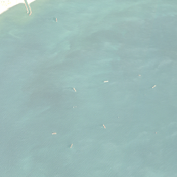
 2026-10-282026-10-15
- Change score
- 0.030
- Pixels changed
- 2.9%
- Clear ground
- 100%
- Cloud now / before
- 0% / 0%
- Night lighti
- Learning, 2026-10-26
1 earlier looks at this site; 5 are needed to judge it against its own normal
Watched: claimed struck on 2026-10-16 (Houthis). Baseline is the clearest scene before 2026-10-16.
HS Dignity
Learningi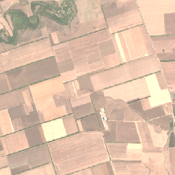
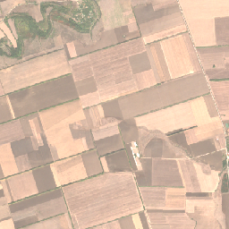 2026-10-152026-10-05
- Change score
- 0.029
- Pixels changed
- 9.0%
- Clear ground
- 100%
- Cloud now / before
- 0% / 0%
- Night lighti
- Learning, 2026-10-25
0 earlier looks at this site; 5 are needed to judge it against its own normal
Watched: reported damaged on 2026-10-19 (Kyiv Independent). Baseline is the clearest scene before 2026-10-12.
Al-Maashiq Palace
Learningi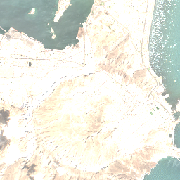
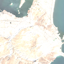 2026-10-182026-10-13
- Change score
- 0.027
- Pixels changed
- 22.9%
- Clear ground
- 96%
- Cloud now / before
- 0% / 4.5%
- Night lighti
- Learning, 2026-10-25
0 earlier looks at this site; 5 are needed to judge it against its own normal
Watched: confirmed damaged on 2026-10-15 (Yemen health minister Qasim Buhaibeh). Baseline is the clearest scene before 2026-10-15.
Tolyattikauchuk
Learningi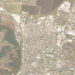
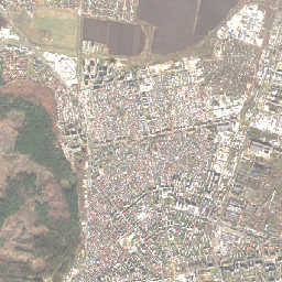 2026-10-272026-10-22
- Change score
- 0.025
- Pixels changed
- 4.8%
- Clear ground
- 100%
- Cloud now / before
- 0% / 0%
- Night lighti
- Learning, 2026-10-26
1 earlier looks at this site; 5 are needed to judge it against its own normal
Watched: claimed struck on 2026-10-24 (General Staff). Baseline is the clearest scene before 2026-10-24.
Aramco Headquarters Dhahran
Learningi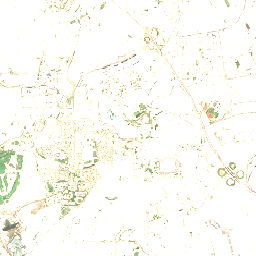
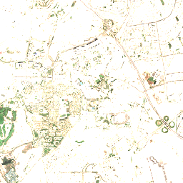 2026-10-252026-10-05
- Change score
- 0.022
- Pixels changed
- 26.8%
- Clear ground
- 100%
- Cloud now / before
- 0% / 0%
- Night lighti
- Learning, 2026-10-25
1 earlier looks at this site; 5 are needed to judge it against its own normal
Watched: claimed struck on 2026-10-14 (Houthi spokesman Yahya Saree). Baseline is the clearest scene before 2026-10-13.
Ras Isa oil terminal
Learningi
 2026-10-282026-10-11
- Change score
- 0.021
- Pixels changed
- 1.1%
- Clear ground
- 100%
- Cloud now / before
- 0% / 0%
- Night lighti
- Learning, 2026-10-26
2 earlier looks at this site; 5 are needed to judge it against its own normal
Watched: claimed struck on 2026-10-13 (Saudi-led coalition). Baseline is the clearest scene before 2026-10-13.
Aden International Airport
Learningi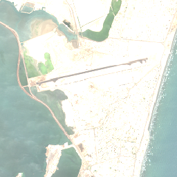
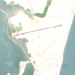 2026-10-182026-10-15
- Change score
- 0.021
- Pixels changed
- 16.6%
- Clear ground
- 100%
- Cloud now / before
- 0% / 0%
- Night lighti
- Learning, 2026-10-25
0 earlier looks at this site; 5 are needed to judge it against its own normal
Watched: claimed struck on 2026-10-28 (Houthis); in the daily's developments. Baseline is the clearest scene before 2026-10-16.
Novoshakhtinsk oil-loading terminal
Learningi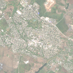
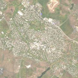 2026-10-112026-10-06
- Change score
- 0.019
- Pixels changed
- 3.5%
- Clear ground
- 100%
- Cloud now / before
- 0% / 0%
- Night lighti
- Learning, 2026-10-24
0 earlier looks at this site; 5 are needed to judge it against its own normal
Watched: reported damaged on 2026-10-09 (reported via themoscowtimes.com). Baseline is the clearest scene before 2026-10-09.
Badr Camp
Learningi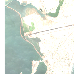
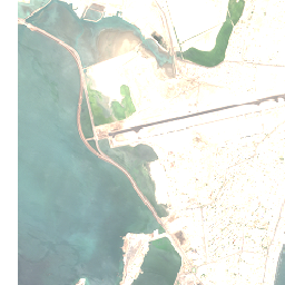 2026-10-182026-10-15
- Change score
- 0.018
- Pixels changed
- 10.9%
- Clear ground
- 94%
- Cloud now / before
- 0% / 0%
- Night lighti
- Learning, 2026-10-21
0 earlier looks at this site; 5 are needed to judge it against its own normal
Watched: claimed struck on 2026-10-16 (Houthi-affiliated media). Baseline is the clearest scene before 2026-10-16.
King Khalid Air Base
Learningi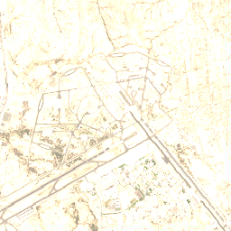
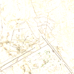 2026-10-262026-10-21
- Change score
- 0.017
- Pixels changed
- 1.8%
- Clear ground
- 100%
- Cloud now / before
- 0% / 0%
- Night lighti
- Learning, 2026-10-23
0 earlier looks at this site; 5 are needed to judge it against its own normal
Watched: claimed struck on 2026-10-24 (Houthi spokesman Yahya Saree). Baseline is the clearest scene before 2026-10-24.
Rabigh Refinery
Learningi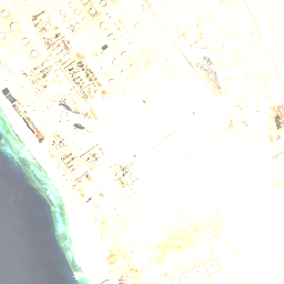
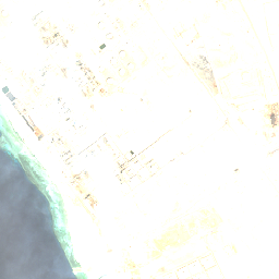 2026-10-252026-10-17
- Change score
- 0.015
- Pixels changed
- 27.4%
- Clear ground
- 100%
- Cloud now / before
- 0.1% / 0%
- Night lighti
- Learning, 2026-10-23
0 earlier looks at this site; 5 are needed to judge it against its own normal
Watched: claimed struck on 2026-10-24 (Houthi spokesman Yahya Saree). Baseline is the clearest scene before 2026-10-24.
al-Alam camp
Learningi
 2026-10-282026-10-18
- Change score
- 0.014
- Pixels changed
- 3.1%
- Clear ground
- 100%
- Cloud now / before
- 0% / 0%
- Night lighti
- Learning, 2026-10-26
1 earlier looks at this site; 5 are needed to judge it against its own normal
Watched: confirmed damaged on 2026-10-19 (Yemen officials). Baseline is the clearest scene before 2026-10-19.
Chelsea 3
Learningi
 2026-10-152026-10-05
- Change score
- 0.013
- Pixels changed
- 4.1%
- Clear ground
- 100%
- Cloud now / before
- 0% / 0%
- Night lighti
- Learning, 2026-10-25
0 earlier looks at this site; 5 are needed to judge it against its own normal
Watched: reported damaged on 2026-10-19 (Kyiv Independent). Baseline is the clearest scene before 2026-10-12.
Abha International Airport
Learningi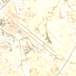
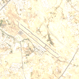 2026-10-212026-10-14
- Change score
- 0.010
- Pixels changed
- 5.0%
- Clear ground
- 100%
- Cloud now / before
- 0% / 0%
- Night lighti
- Learning, 2026-10-25
0 earlier looks at this site; 5 are needed to judge it against its own normal
Watched: claimed struck on 2026-10-22 (Houthis). Baseline is the clearest scene before 2026-10-15.
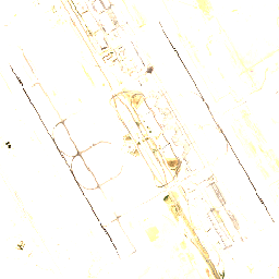
King Khalid International Airport
Learningi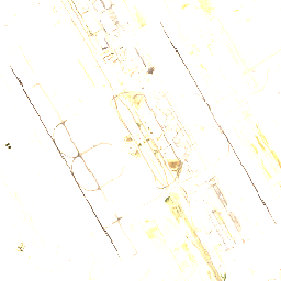
 2026-10-182026-10-06
- Change score
- 0.006
- Pixels changed
- 10.9%
- Clear ground
- 100%
- Cloud now / before
- 0% / 0%
- Night lighti
- Learning, 2026-10-25
0 earlier looks at this site; 5 are needed to judge it against its own normal
Watched: claimed struck on 2026-10-24 (Houthi spokesman Yahya Saree). Baseline is the clearest scene before 2026-10-10.
Pivdenny Bridge
One picture so far (2026-10-11); a second scene is needed for a comparison.
Watched: reported damaged on 2026-10-27 (reported via kyivindependent.com). Baseline is the clearest scene before 2026-10-22.
Yara J
One picture so far (2026-10-03); a second scene is needed for a comparison.
Watched: reported damaged on 2026-10-19 (Kyiv Independent). Baseline is the clearest scene before 2026-10-14.
Azot Novomoskovsk
One picture so far (2026-10-27); a second scene is needed for a comparison.
Watched: reported damaged on 2026-10-28 (Daily intelligence report); in the daily's developments. Baseline is the clearest scene before 2026-10-28.
Novolipetsk Steel (NLMK Lipetsk)
One picture so far (2026-10-27); a second scene is needed for a comparison.
Watched: reported damaged on 2026-10-28 (Daily intelligence report); in the daily's developments. Baseline is the clearest scene before 2026-10-28.
State University of Trade and Economics
One picture so far (2026-10-11); a second scene is needed for a comparison.
Watched: reported damaged on 2026-10-27 (reported via kyivindependent.com). Baseline is the clearest scene before 2026-10-27.
MegaGRINN shopping complex
One picture so far (2026-10-12); a second scene is needed for a comparison.
Watched: reported damaged on 2026-10-25 (Belgorod Operational Headquarters). Baseline is the clearest scene before 2026-10-25.
Kyiv-4 (Darnytska) Power Plant
One picture so far (2026-10-11); a second scene is needed for a comparison.
Watched: reported damaged on 2026-10-14 (reported via france24.com). Baseline is the clearest scene before 2026-10-14.
King Khalid International Airport
One picture so far (2026-10-18); a second scene is needed for a comparison.
Watched: claimed struck on 2026-10-25 (Houthi spokesman Yahya Saree). Baseline is the clearest scene before 2026-10-25.
Kiev
One picture so far (2026-10-11); a second scene is needed for a comparison.
Watched: reported damaged on 2026-10-13 (Daily intelligence report). Baseline is the clearest scene before 2026-10-13.
Bosporus
One picture so far (2026-10-10); a second scene is needed for a comparison.
Watched: chokepoint under maritime watch.
Strait of Hormuz
One picture so far (2026-10-09); a second scene is needed for a comparison.
Watched: chokepoint under maritime watch.
Strait of Malacca
One picture so far (2026-09-29); a second scene is needed for a comparison.
Watched: chokepoint under maritime watch.
Aramco facility in Yanbu
One picture so far (2026-10-20); a second scene is needed for a comparison.
Watched: claimed struck on 2026-10-22 (Houthis). Baseline is the clearest scene before 2026-10-22.
Saudi defence ministry headquarters in Riyadh
One picture so far (2026-10-18); a second scene is needed for a comparison.
Watched: claimed struck on 2026-10-22 (Houthis). Baseline is the clearest scene before 2026-10-22.
Watched, no picture yet (3)
- Bab el-Mandeb: no usable Sentinel-2 scene in the last 30 days
- Suez Canal: no usable Sentinel-2 scene in the last 30 days
- Taiwan Strait: no usable Sentinel-2 scene in the last 30 days
How the places are chosen: ledger places with a damage statement in the last 30 days (weighted by how firmly it is stated, faded with age), places the daily's developments named in the last two days, and the maritime chokepoints, a dozen at a time, the most overdue first. A place with a dated statement is compared against the clearest scene from before it. Pictures are cropped to about 5 km at 20 m a pixel, from the least cloudy of the newest scenes, and a pair that is mostly cloud is inconclusive rather than changed. Night lights are NASA VIIRS, a few days behind.
Contains modified Copernicus Sentinel data (ESA), served by Microsoft Planetary Computer; processed by Ohmega. Night lights: NASA VIIRS via GIBS (NASA EOSDIS). Machine access: /api/v1/satellite.